What Does GPS Stand For? How Handheld GPS Units Find You
GPS stands for Global Positioning System. Here is how satellites, timing signals and a handheld receiver combine to place you on the map, and what affects the fix off-grid.
The Folio & Current Team
November 5, 2026 · 6 min read

What does GPS stand for? It stands for Global Positioning System, a satellite-based navigation system owned by the US government. A GPS receiver listens to timing signals from several satellites and uses them to calculate its position, altitude and the time. A handheld unit only receives these signals; it does not transmit anything to the satellites.
This guide answers the question what does GPS stand for, then covers how a handheld finds you, how many satellites are involved, what affects accuracy off-grid, and what to check before you rely on one.
What does GPS stand for, word by word
Each word in the name describes part of the job.
| Letter | Word | What it means in practice |
|---|---|---|
| G | Global | Satellites orbit Earth so a receiver can pick up signals across the planet, wherever it has a view of the sky. |
| P | Positioning | The receiver works out where it is: latitude, longitude and altitude. |
| S | System | Satellites, ground control stations and user receivers work together as one network. |
The word system matters. Your handheld is only the last piece of a chain that starts in orbit. A US government overview of the Global Positioning System describes the same three parts.
The three segments of the system
Navigation references often split GPS into a space segment, a control segment and a user segment. Knowing which is which explains why a unit can work with no cell service at all.
| Segment | What it is | What it does for you |
|---|---|---|
| Space segment | The satellites in orbit | Broadcast signals carrying the satellite's position and the exact time |
| Control segment | Ground stations that monitor the satellites | Track orbits, check the onboard clocks and upload corrections |
| User segment | Receivers, including handheld units | Pick up the signals and calculate a position |
Because the signals come straight from space, a receiver does not need towers or an internet connection. A standalone handheld can keep working where a phone shows no bars.
How a handheld GPS unit finds you
Each satellite carries an atomic clock and broadcasts its position along with the time the signal left. Your receiver compares that time with its own clock to work out how long the signal took to arrive, and therefore how far away the satellite is. The method of combining several of those distances is called trilateration.
Trilateration in plain steps
- One satellite's distance places you somewhere on an imaginary sphere around it.
- A second satellite narrows that to a circle where two spheres meet.
- A third narrows it to two points, and one of them is far out in space, so it can be discarded.
- A fourth satellite corrects the receiver's own clock, which is far less precise than an atomic clock. That is why four satellites is the minimum for a full position with altitude.
Distance here is signal travel time multiplied by the speed of light, so tiny clock errors turn into position errors. This is the reason the satellites carry such precise clocks.

How many GPS satellites are there?
The system is designed around a constellation of 24 satellites arranged so that several are above the horizon from most places on Earth. In practice the operators keep additional satellites in orbit as spares and replacements, so the number in service can be higher than 24. A space agency explainer on how GPS works shows the orbits in simple diagrams.
You do not need to count them. What matters is how many your receiver can hear at once, and that depends on the sky around you.
Fix time and accuracy when you are off-grid
A satellite fix is the moment the receiver has locked onto enough satellites to calculate a position. The first fix after switching on, or after traveling a long way with the unit off, can take longer than a restart in the same spot. Results vary with the unit and the conditions, so consider any single reading an estimate.
| Condition | Effect on the fix | What to do |
|---|---|---|
| Open ridge or clearing | Many satellites in view | Wait for the fix before you start moving |
| Dense tree canopy | Signals weakened, fewer satellites heard | Step into a gap and let the unit settle |
| Canyon or tall buildings | Signals bounce off walls and reach the receiver late, adding error | Move to where more sky is visible |
| Inside a tent, pack or vehicle | Signals blocked or reduced | Carry the unit on a pack strap or belt loop with the screen facing up |
| Atmosphere and space weather | Signals slowed or disturbed on the way down | Expect small errors and cross-check with a map |
Other error sources include clock drift and satellites bunched together in one part of the sky. Altitude readings are usually less certain than the horizontal position, so do not use them as survey data.
Field note
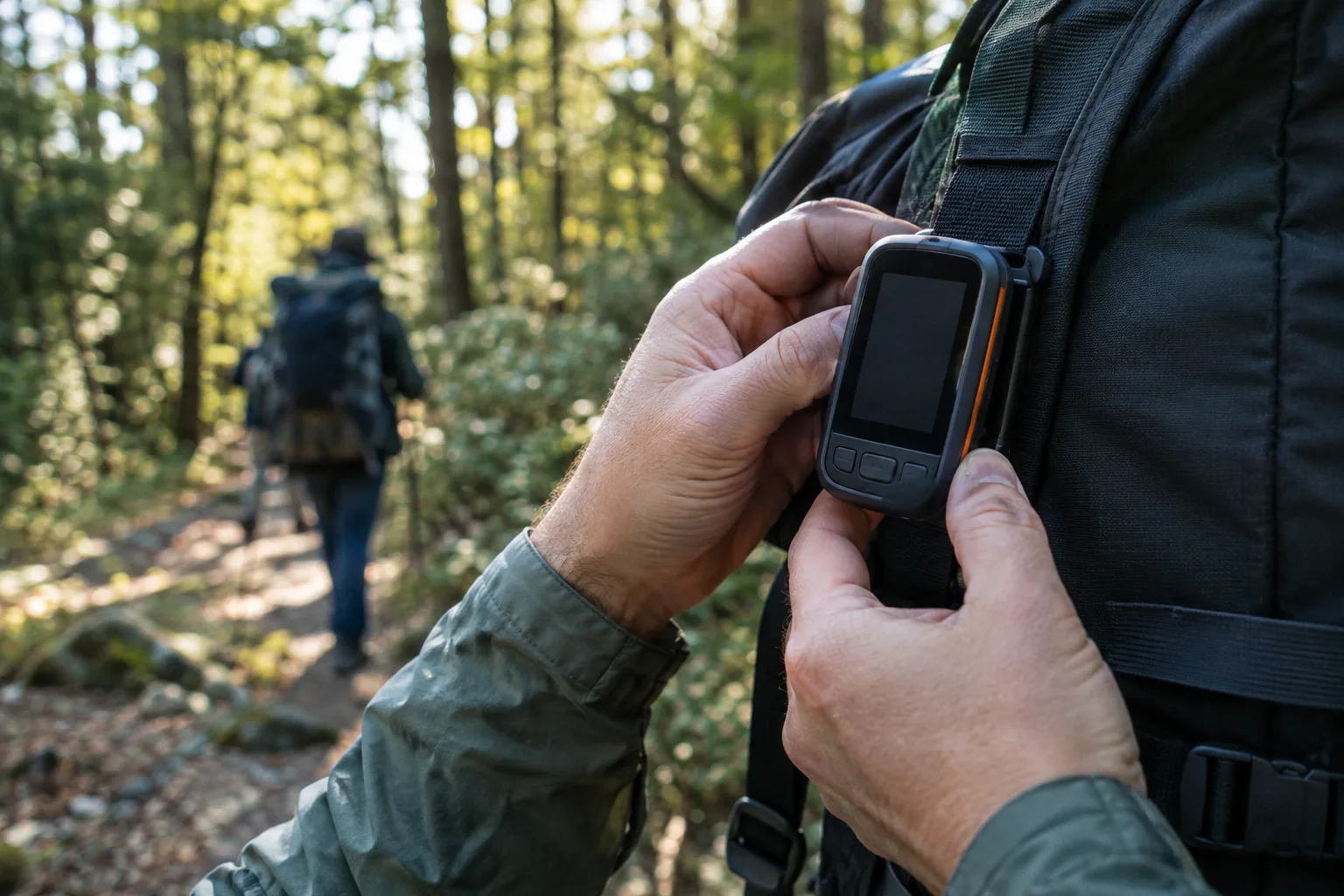
Power on the unit in the open before you set off, wait for the satellite fix, then put it on your pack. Starting the fix under trees or in a vehicle makes the first lock harder to get.
What are the alternatives to GPS?
GPS is one of several global navigation satellite systems. Other countries and regions operate their own constellations, and many modern receivers can read more than one. The principle is the same: timed signals from space and trilateration on the ground.
Without any satellites, you still have options:
- A paper topographic map and a magnetic compass, which need no power.
- Dead reckoning, where you track heading, pace and time from a known point.
- Terrain association, matching ridges, streams and trails to your map.
- Ground-based radio navigation, which aircraft and ships use near transmitters.
Carry the map and compass even with a handheld. Batteries, damage and heavy cover can all interrupt a fix.
Using a handheld GPS unit off-grid
A handheld GPS receiver reads satellite signals and shows your position. Two units in the store take different approaches, and which fits depends on whether you travel alone or with a group.
A standalone navigator
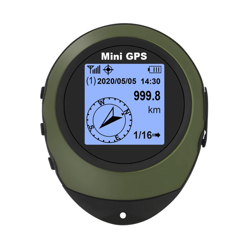
SkyTrace Nav is a handheld GPS device that reads satellite signals directly rather than through cell towers, so navigation does not depend on a phone or an app. Once it has a satellite fix, the screen shows your longitude, latitude and altitude. It holds 16 waypoints, and a three-button interface lets you set waypoints or destination coordinates and switch between saved destinations. An integrated carabiner clip attaches it to a pack or belt loop, and it charges with the included USB cable rather than using AA batteries.
 In this guideSkyTrace Nav$119.99View
A GPS radio for groups
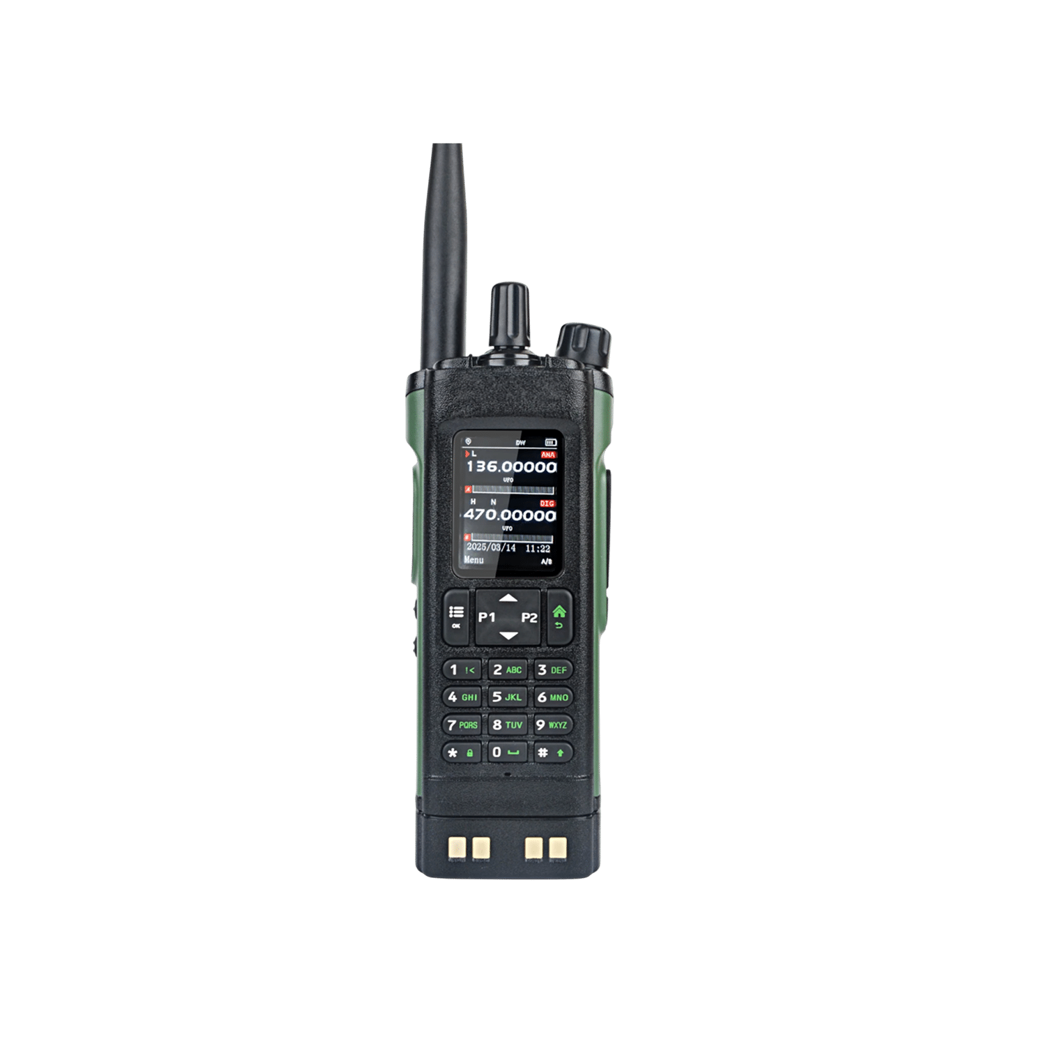
AtlasWave pairs built-in GPS with a multi-band radio covering FM, Air Band, VHF and UHF. Its GPS finds your position and sends it by radio to other AtlasWave units in your group, without cell towers, so each unit can show where the others are. A 2500mAh rechargeable battery powers both the GPS and the voice radio, and built-in weather channels let you listen to broadcast weather alerts. Browse more options in our Radios & Emergency Comms collection.
 In this guideAtlasWave$179.99View
Setup checklist before you leave
- Charge the unit with its cable and follow the manual for first-time setup.
- Power on in the open and wait for a satellite fix.
- Save your trailhead, camp and exit points as waypoints before you lose signal.
- Check that the coordinates match your map's coordinate format.
- Pack a paper map and compass as a backup.
- Tell someone your route and when you plan to be back.
If you are comparing radios for group travel or emergencies, our guide to emergency radio power sources and bands explains what to check.
Common mistakes with handheld GPS
- Reading position before the unit has a fix.
- Assuming altitude is exact.
- Keeping the unit buried in a pack or pocket.
- Skipping a backup navigation method.
- Confusing GPS, the US system, with the general term for satellite navigation.